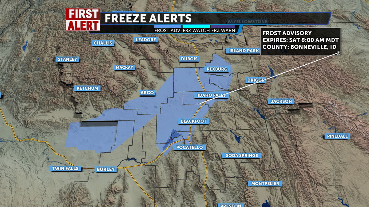
First Alert Weather Weekend; frost advisory for Saturday morning
The leading edge of low pressure is moving in for Friday evening. It’s going to be fairly chilly overnight, prompting the National Weather Service to issue a Frost Advisory. We see a strong cold front Saturday, with the potential for severe thunderstorms.
FROST ADVISORY IN EFFECT FROM 2 AM TO 8 AM SATURDAY
- WHAT…Temperatures below 37 degrees may pose a risk to uncovered outdoor vegetation.
- WHERE…Shoshone/Lava Beds, Arco/Mud Lake Desert, Lower Snake River Plain, and Upper Snake River Plain.
- WHEN…From 2 AM to 8 AM MDT Saturday.
- IMPACTS…The cold could harm sensitive outdoor vegetation. Sensitive outdoor plants may be killed if left uncovered.
- ADDITIONAL DETAILS…Temperatures are forecast to remain above 37 degrees in our population centers.
Friday night and early Saturday, a chance of showers and thunderstorms. Partly cloudy, with a low around 38°. South winds around 10 to 15 mph, with gusts as high as 25 mph.
For Saturday, there is a chance of showers and thunderstorms. Some of the storms may be severe. Mostly cloudy, with a high near 67°. Southwest winds around 15 to 20 mph, with gusts as high as 25 mph.
Sunday, scattered snow and rain with a thunderstorm possible. A high temperature near 50°. South southwest winds around 15 to 20 mph, with gusts as high as 25 mph. Chance of precipitation is 90%.
Monday, there is a slight chance of showers and thunderstorms. Partly sunny, with a high near 58°.